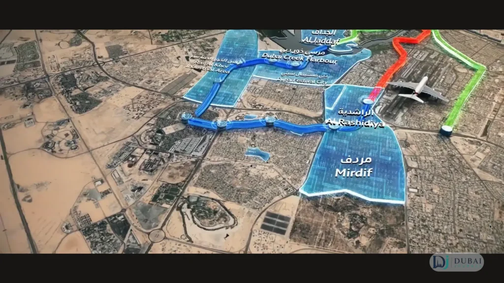
The Dubai Metro Blue Line map is a Y. Thirty kilometres of track, 14 stations and two branches that meet at International City 1. One branch starts at Creek on the Green Line and runs out to Academic City. The other starts at Centrepoint on the Red Line and runs to the same junction.
Opening is set for 9 September 2029, exactly 20 years after the metro’s first day. RTA expects 200,000 riders a day in 2030, rising to 320,000 by 2040.
The Blue Line routes
| Attribute | Detail |
|---|---|
| Shape | Y with two branches meeting at International City 1 |
| Length | 30 km: 15.5 km underground and 14.5 km elevated |
| Stations | 14 (9 elevated, 5 underground) |
| Creek branch | Creek (Green Line) to Academic City, 21 km |
| Centrepoint branch | Centrepoint (Red Line) to International City 1, 9 km |
| Junction | International City 1, an underground interchange |
| Depot | Al Ruwayyah 3 |
| Cost | More than AED 20.5 billion |
| Areas served | 9, expected to hold about 1 million people by 2040 |
| Train frequency | About one every 90 seconds, 56,000 passengers an hour across both directions |
| Network size after opening | 131 km, up from 101 km (metro and tram) |
| Opening | 9 September 2029 |
Stops on each branch
Stops below run in travel order, starting from the existing metro line each branch connects to.
Creek branch: Green Line to Academic City
- Creek, the interchange with the Green Line in Al Jaddaf
- Dubai Festival City
- Dubai Creek Harbour (Emaar Properties Station), the 74-metre station
- Ras Al Khor Industrial Area
- International City 1, the underground junction with the Centrepoint branch
- International City 2
- International City 3
- Dubai Silicon Oasis
- Dubai Academic City
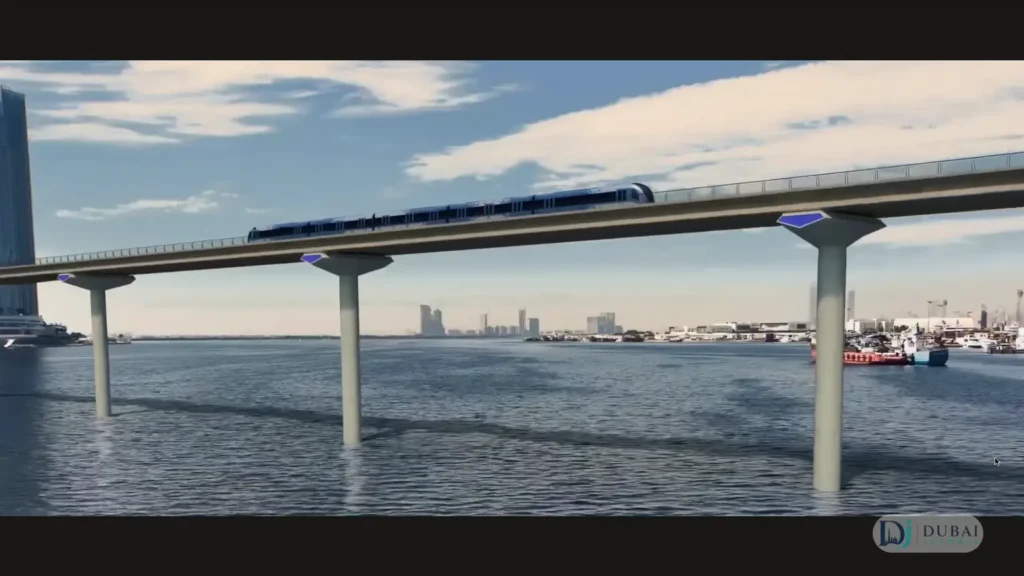
The line crosses Dubai Creek on a 1.3 km metro bridge, the first metro bridge to span the Creek.
Centrepoint branch: Red Line to International City 1
- Centrepoint, the interchange with the Red Line in Al Rashidiya
- Mirdif
- Al Warqa
- International City 1
This is the short arm of the Y at 9 km. Tunnelling on this side runs from International City 1 toward Mirdif.
Two future stations
RTA’s route map marks 12 named stops and two further elevated stations as future additions, which brings the total to 14. In RTA’s own breakdown the 14 are three interchanges, seven elevated stations and four underground stations. Counting the interchanges by level gives the 9 elevated and 5 underground in the table above.
Interchanges with the Red & Green lines
| Station | Connects to | Role on the map |
|---|---|---|
| Creek | Green Line | Start of the Creek branch, in Al Jaddaf |
| Centrepoint | Red Line | Start of the Centrepoint branch, in Al Rashidiya |
| International City 1 | The two Blue Line branches | Underground junction, over 44,000 m², sized for about 350,000 riders a day |
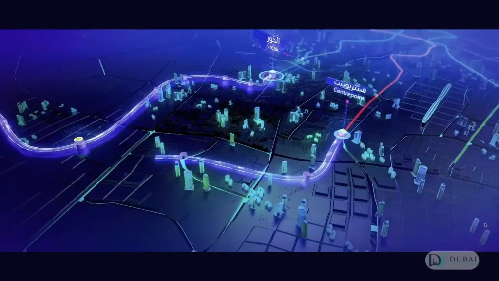
Creek and Centrepoint give the Red and Green lines a second connection through eastern Dubai, alongside Union and BurJuman. Until the Blue Line opens, Red Line and Green Line trains run on the standard Dubai Metro timings.
Which interchange each area uses
| Area | Branch | Nearest existing line |
|---|---|---|
| Dubai Festival City, Dubai Creek Harbour, Ras Al Khor | Creek branch, before the junction | Green Line at Creek |
| Mirdif, Al Warqa | Centrepoint branch | Red Line at Centrepoint |
| International City, Silicon Oasis, Academic City | Creek branch, past the junction | Green Line at Creek or Red Line at Centrepoint, both reached through International City 1 |
Every trip that crosses from one branch to the other goes through International City 1.
The two landmark stations
Emaar Properties Station at Creek Harbour
At 74 metres, this will be the tallest metro station in the world. SOM, the firm behind the Burj Khalifa, designed it, and it covers about 11,000 m². It is sized for up to 160,000 riders a day, with more than 70,000 expected daily by 2040.
The station serves Dubai Creek Harbour, where the estimated population is 40,000.
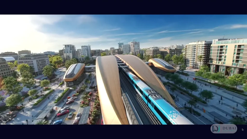
International City 1
The largest underground interchange in the metro network is also where construction is most visible. All three tunnel boring machines start from this station, one heading toward Mirdif, one toward the Auto Market and one toward Al Warsan (International City 2).
The other stations take their interiors from four themes: air (three stations), water (two), earth (four) and fire (two).
Areas the map covers
The line serves nine areas: Al Jaddaf, Dubai Festival City, Dubai Creek Harbour, Ras Al Khor, International City, Dubai Silicon Oasis, Academic City, Mirdif and Al Warqa.
International City gets the densest coverage, with three stations on the Creek branch. Dubai Silicon Oasis is one of the key urban centres named in the Dubai 2040 Urban Master Plan, and Academic City is the far end of the line.
Mirdif and Al Warqa sit on the Centrepoint branch, a 9 km hop to the Red Line. RTA expects the line to cut traffic congestion by 20% along the corridors it serves.
From the Blue Line to Dubai International Airport
The Blue Line reaches Dubai International Airport through the Red Line at Centrepoint. RTA puts journeys from the areas the line serves at about 20 minutes.
- Ride the Blue Line to Centrepoint. From Mirdif or Al Warqa that is a direct run on the Centrepoint branch. From International City, Silicon Oasis or Academic City, the ride passes through International City 1 first.
- Change to the Red Line at Centrepoint.
- Stay on for three stops: Emirates, Airport Terminal 3, then Airport Terminal 1.
Terminal 2 has no Red Line station. The nearest metro stop for Terminal 2 is Abu Hail on the Green Line.
Construction progress & opening date
The consortium of MAPA, LIMAK and CRRC Hong Kong is building the line. RTA launched the primary tunnelling works on 3 May 2026 from International City 1, with the project at 20% completion. More than 10,000 workers and 500 engineers are on the job, and the consortium has logged more than 13 million work hours without a lost-time injury.
The first tunnel boring machine, named Al Wugeisha, is 163 metres long and advances 13 to 17 metres a day. Bridge piers for the Creek crossing are going in.
The project runs its own precast yards. The Al Ruwayyah 3 factory casts 10 to 12 viaduct segments a day, and the International City factory casts 12 tunnel rings a day.
| Date | Milestone |
|---|---|
| November 2023 | Route approved |
| December 2024 | Main contract awarded |
| June 2025 | Foundation stone laid |
| November 2025 | 10% complete |
| May 2026 | Tunnelling launched, 20% complete |
| End of 2026 | 30% completion targeted |
| 9 September 2029 | Opening |
FAQ
How many stations will the Blue Line have?
Fourteen: 12 named stops plus two elevated stations marked for the future. RTA’s breakdown is three interchange stations, seven elevated and four underground.
Where does the Blue Line start & end?
It has two starting points, Creek on the Green Line and Centrepoint on the Red Line. The Creek branch ends at Academic City, and the Centrepoint branch ends at International City 1.
Is Al Ruwayyah 3 a Blue Line station?
No. Al Ruwayyah 3 is the site of the Blue Line depot and maintenance facility.
Does the Blue Line go to Dubai International Airport?
It connects to the airport through the Red Line. Ride to Centrepoint, change to the Red Line, and the airport terminals are the second and third stops.
Which is the tallest Blue Line station?
Emaar Properties Station at Dubai Creek Harbour, at 74 metres, the tallest metro station in the world.
When does the Blue Line open?
On 9 September 2029.
What to do next
- Match your area to its branch in the table above, then note which of Creek or Centrepoint you would use to reach the existing network.
- Plan airport trips around the Centrepoint transfer and the three-stop Red Line leg.
